MotoNomad
EN

● Features

Everything for the road.

Navigation, weather and a notebook in one app, built for gloved hands and weak signal. Here's what you get.

01

What lies ahead

No more pulling over on the hard shoulder to check the weather. MotoNomad shows what's waiting on your road, in kilometres along the route. Without a route it looks along your heading, 20, 30 or 50 km ahead.

  • A forecast every 10 km for the time you'll get there: rain, temperature, wind, visibility
  • Rain radar on the map with your heading drawn through the rain band, so you can see whether you'll skirt it
  • The next two fuel stations on your route and your range to them; one tap routes you through the one you pick; stations from 60 European countries are built in and work without signal
  • Sharp bends and hairpins worked out from the shape of the route, with a voice warning if you want it
  • Speed limit on screen and a warning when you're going too fast
  • “Gravel in 3 km”: unpaved stretches on the line and in the voice guidance
  • The EU zone border on the line; beyond it, saving mode, so you don't burn through pricey data

Anything from the internet always shows its age. After 15 minutes the marker changes colour and says “data from 22 min ago”, so you know where you stand.
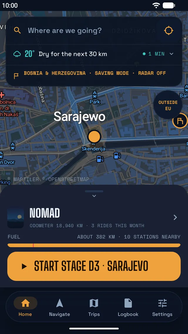
Home screen in Sarajevo: weather for the next 30 km, saving mode outside the EU, fuel range and the Start stage button

02

Navi­gation

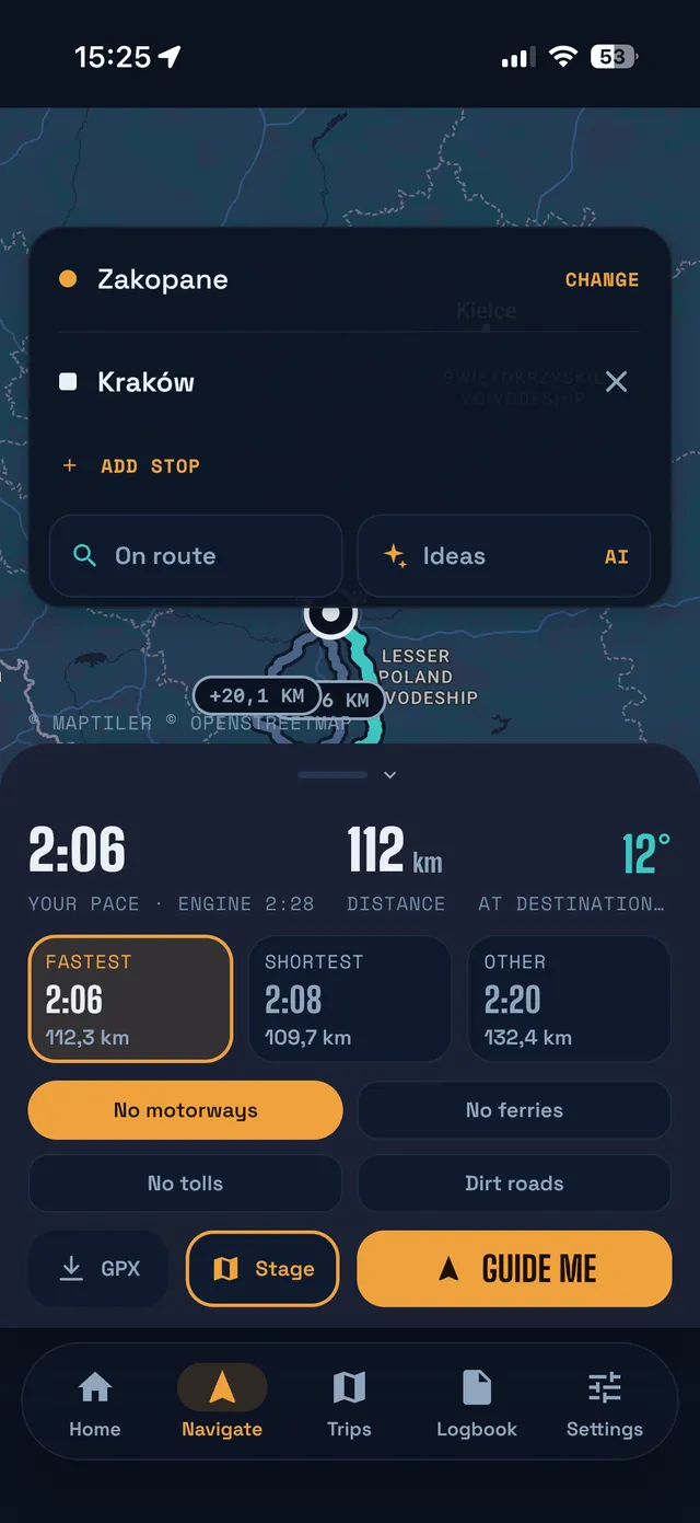
Type a destination or long-press the map. You get several route variants with time, distance, climb and surface. After a few rides, travel times are calculated at your own pace.

  • Road or ADV: strictly tarmac, or with forest and farm tracks thrown in; in ADV there's a “More gravel” card
  • No motorways, ferries or tolls, remembered for next time
  • A loop by time or by distance: “I've got 3 hours” and you're back home, through a point you pick if you like
  • Several stops on the way; one you've already passed can drop out of the route on its own
  • A route from a file with directions to its start, your own stops and “End here”; or just a compass along the track
  • Elevation profile with climbs and surface, before you set off
  • Directions in your intercom; the music only dips while they play
  • Guidance without signal along the route already calculated; leave it and you'll hear how far it is back
  • Android Auto and CarPlay: map, guidance, weather and stations on the car screen, free
Fastest, shortest and other route variants with time and distance

03

Ride screen

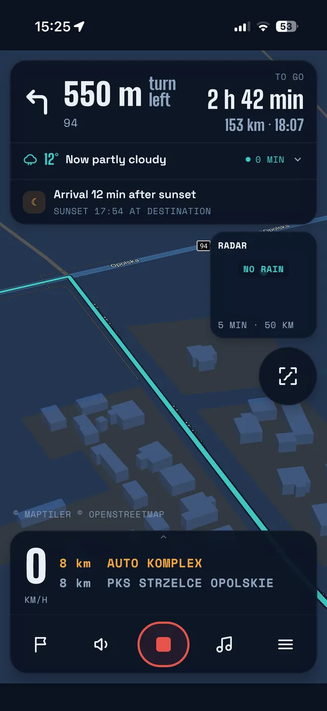
Everything at once, readable in half a second: the next turn, weather, radar, speed, fuel and a strip of the kilometres ahead. Every button is big enough to hit wearing gloves.

  • Arrow and distance in big digits, time to destination and arrival time
  • Save a stop with one tap; “it was a fuel station” logs the refuel right away
  • Swipe up: a big speedometer inside the fuel arc, no map
  • Hide what you don't need and get more map
  • Dark or light theme, easy to read at night and in full sun
  • Pause and next track without leaving navigation (Android)
Ride screen with the next turn, weather, rain radar and fuel stations

04

Trips

You plan at home, and on the road one tap starts the day's stage. Each morning the route is calculated from where you are, via the points you haven't reached yet.

  • Ready-made trip ideas: dozens of routes in Poland, filtered by days and by tarmac or off-road, and “Plan the trip” splits them into stages
  • Days, waypoints, overnight stops; resume an interrupted stage right where you left off
  • Your own track for the whole trip split into days, with an overnight stop at the end of each
  • A budget in euros, forints or dinars at the exchange rate on the day you paid, so the total doesn't shift from day to day
  • Refuels on a trip log themselves as expenses
  • Morning weather for the stage in a notification before you set off (Pro)
  • Notes for the whole trip and for each stage, all in one place
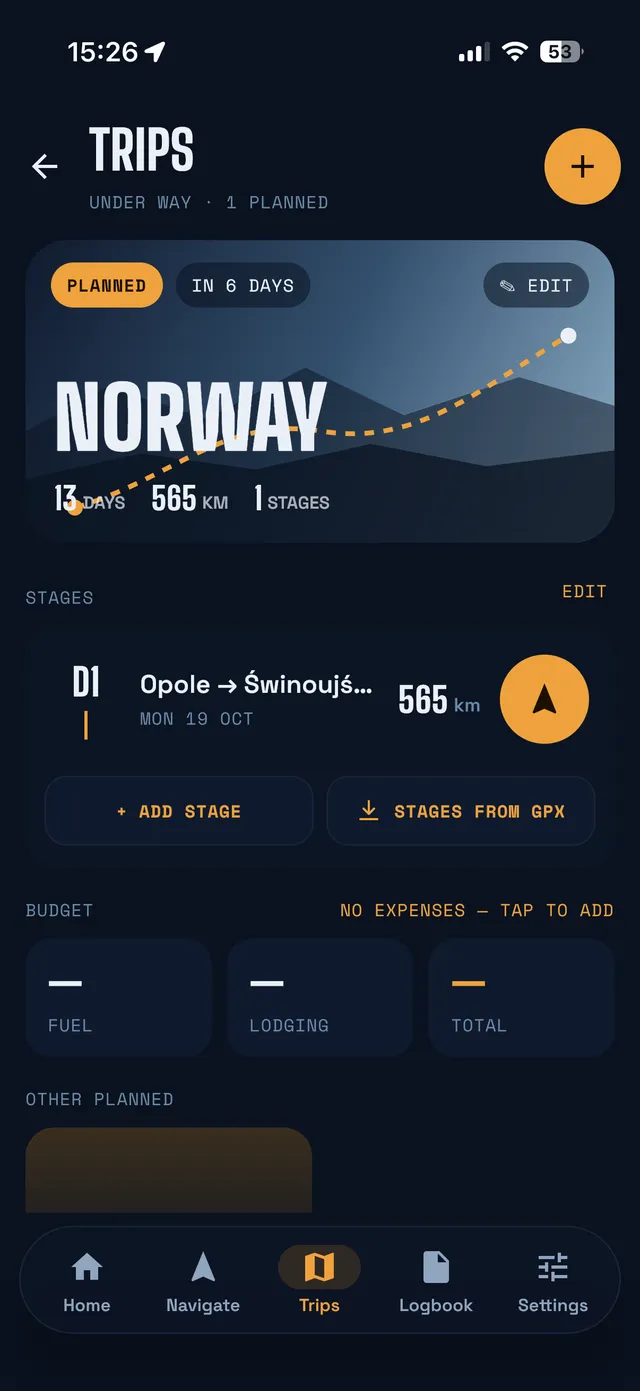
A planned trip to Norway with its stage and budget

05

Logbook

Every ride records itself, and in the evening you have the whole day in one place: rides, places, refuels and notes.

  • Just ride off and it records, with your phone in your pocket (Pro)
  • Track, distance, moving time, average and top speed, climbs and elevation profile
  • How far you leaned into the bends: approximate lean left and right from a phone on the mount
  • Voice notes on the go, turned into text on your phone
  • GPX export and import, always free
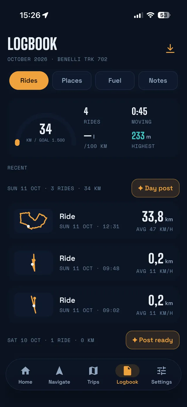
Logbook with the monthly goal and a list of rides

06

AI assistant

It helps you plan the day and write about it in the evening. It only speaks up when you ask, never while you're riding.

  • Route ideas: peaks, castles, viewpoints and roadside coffee, with the distance from the route and a short “why”
  • Day post for Instagram, Facebook or your blog, matter-of-fact or tongue-in-cheek
  • A recorded note becomes proper text, facts unchanged
  • 1 request a day free, 20 in Pro

The assistant gets town names and the day's numbers, not your GPS position or track.

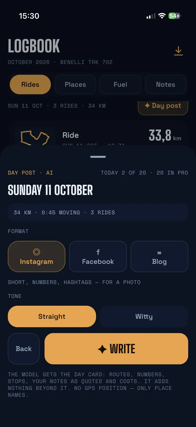
Day post: choosing the format (Instagram, Facebook, blog) and the tone

07

Garage and fuel

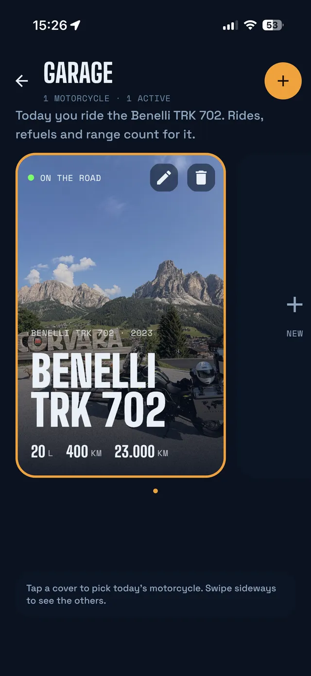
Your motorcycle gets its own cover: in its paint colour and category, or with your own photo. Rides, refuels and range are logged to it.

  • How far you can still go, with a red reserve mark on the fuel bar
  • Real fuel consumption between full-tank fill-ups, even if you miss logging one
  • Your make on the list, from Honda and BMW to CFMoto, QJ Motor and Zontes
Garage with the cover of a Benelli TRK 702

08

Motorcycle display

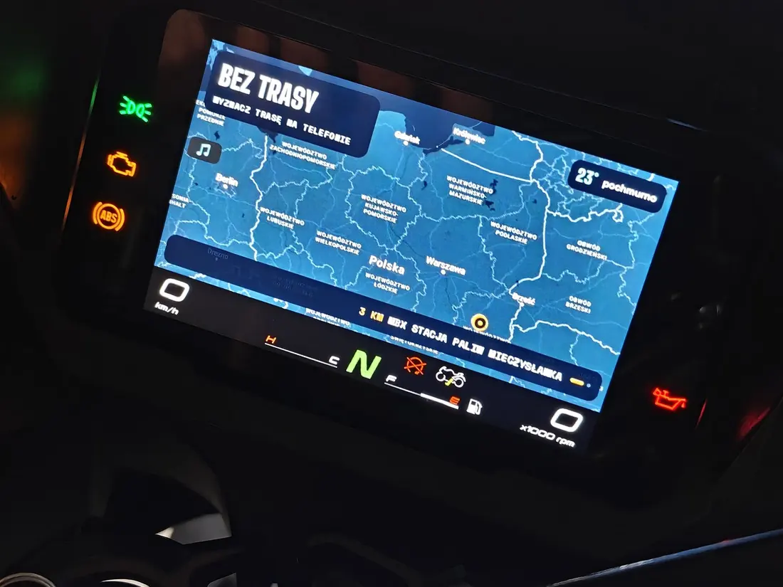
Got a colour display that connects to your phone over Wi-Fi? The phone rides in your pocket and the map is on the dash.

  • Navigation, cockpit and roadbook on the dash (EasyConn / Carbit), on Android and iPhone
  • Switch screens with the handlebar buttons
  • Pair once, then it connects by itself, even after you switch off at a fuel station
Which motorcycles and how it works
MotoNomad on the display of a CFMOTO 700MT

Good to know

Short and to the point.

  • The map needs the internetThe map and planning a new route need a connection. When you lose signal, guidance along the route already calculated, recording and the logbook carry on, and the weather shows its age.
  • Routes by road type, not by bendsYou choose Road or ADV and whether to use motorways, ferries and tolls. The routing engine can't tell how twisty a road is, so we don't promise “twisty routes”.
  • All over EuropeThe app knows which country you're in, even offline, and outside EU roaming (Serbia, Bosnia, Albania, Switzerland…) it saves data by itself.
  • 10 languagesPolish, English, German, Italian, French, Spanish, Czech, Slovak, Dutch and Portuguese. Map labels, voice guidance and the AI all use the app's language.
  • Your rate, your moneyWe suggest the average exchange rate of the National Bank of Poland (NBP) from the day of purchase; if the bureau de change gave you a different rate, enter your own.

Next

Try it on the road.